Across the Alborz Mountains
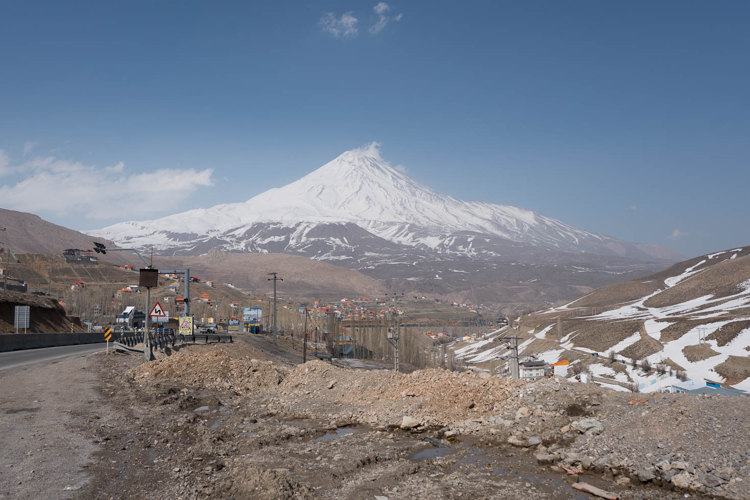
The Alborz Mountains are between the capital Teheran and the Caspian Sea. These mountains have several peaks above 4000 m, the highest of them is Mt. Damavand (5604 m), a volcano. At this time of the year there is still a lot of snow in these mountains, making them a wonderful scenery when looking at them from desert-like areas like Teheran.
Climbing to 2700m
There are only a few passes that cross these mountains, we chose the one that goes closest to Mt. Damavand. After leaving Teheran on a busy highway we had to climb around 1600 m to reach the pass. Unfortunately, even the road up to the pass had a lot of traffic so climbing it was not as relaxing as it could have been. We were rewarded however by wonderful views into the valleys and snowy mountains in perfect weather conditions.
Descending to sea level
After a short lunch we started our descent towards the Caspian Sea. There were still around 120 km so it was unlikely we make it there today, even though it was constantly going down. 7 km after the pass we could finally see Mt. Damavand. We did in total another 80 km from the pass through wonderful valleys, going from Alpine climate down to desert climate and closer to the Caspian Sea to humid climate with green forests and rivers. The scenery was just amazing.
Dangerous traffic and road conditions
While the scenery for our descent was one of the most beautiful and diversified that I have ever seen, the traffic after the pass was mostly a nightmare. There were at least a dozen of narrow tunnels, some of them illuminated, some of them not. In the bidirectional tunnels the ventilation also did not do its job and the exhaust gases from the hundreds of trucks going through those tunnels every day made breathing hard and reduced the visibility considerably.
And there was this constant traffic. I did not count, but in average we got passed by at least 5 vehicles every minute, around one third of them trucks in all sizes. Despite from being dangerous because of the narrow roads, some truck and bus drivers also were passing us with 15-20 cm distance with full speed. I am not so sure if that was controlled or just luck that we did not get hit.
The only positive point: It was constantly going downhill, so the tunnels and dangerous passages went over quicker and in steeper parts we could keep up the speed with the vehicles.
I am not sure if I would recommend to other cyclists to take this road, but for sure I would not recommend this road to anyone in the other direction towards Teheran because of the tunnels, crazy drivers and the low speed when going up.
Campground to ourselves
When the sun was setting slowly, we reached a rest area along the highway where we could rent a small bungalow in a camping. It was very welcome to have a warm showers, cleaning of all the dust and truck exhaust gases from our faces. It was a long and exhausting day with lots of impressions, but now it is time to sleep.


Detailed Track
Max elevation: 2614 m
Min elevation: 346 m
Total climbing: 1945 m
Total descent: -3155 m
Total time: 09:39:23